When you click on links to various merchants on this site and make a purchase, this can result in this site earning a commission. Affiliate programs and affiliations include, but are not limited to, the eBay Partner Network.
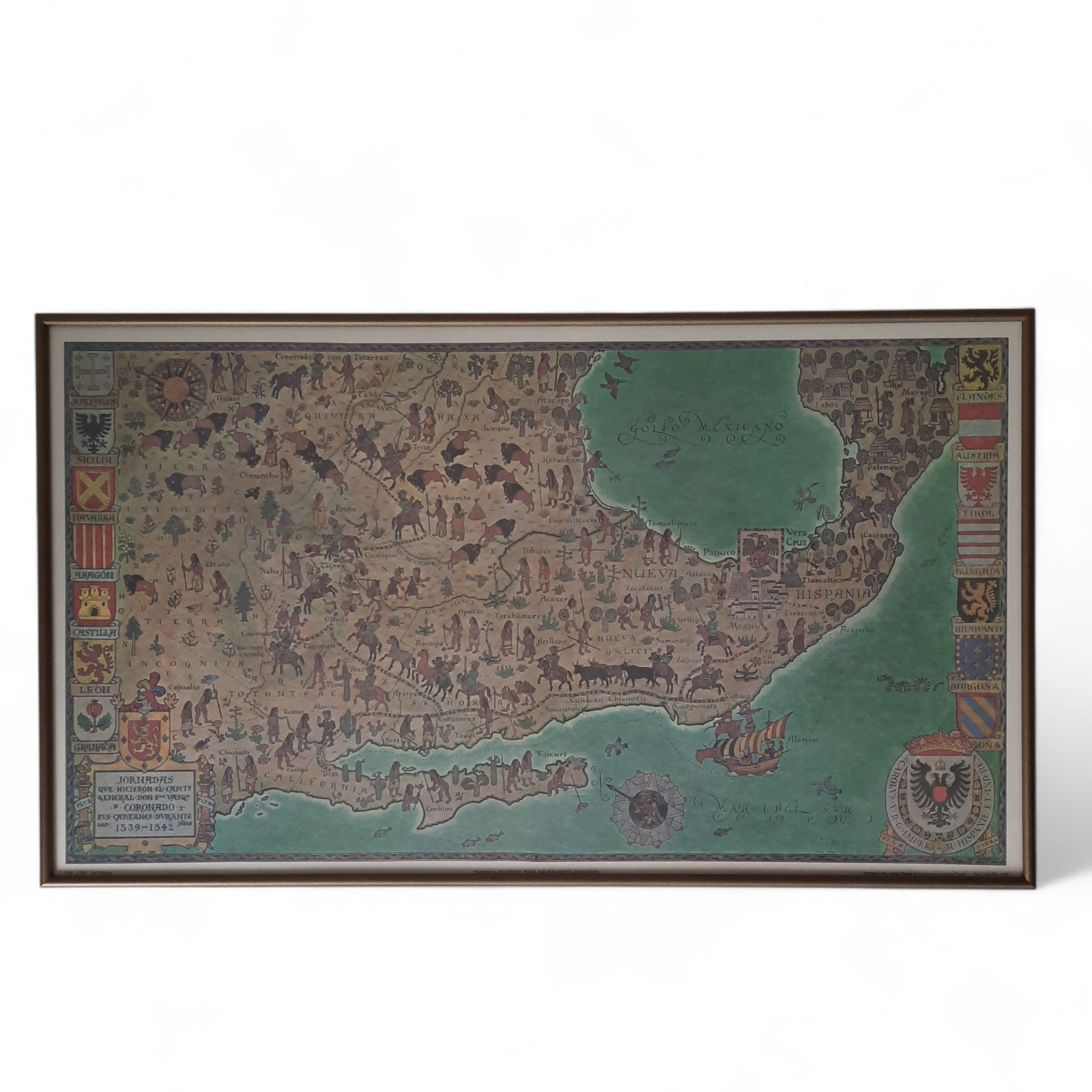
Framed, pictorial journey of spanish conquistador Francisco Vázquez deCoronado through modern day Mexico and the southwestern UnitedStates between 1539–1542. A legendary feat of exploration. In his searchfor Seven Cities of Gold he led parties accross thousands of miles ofunknown territories. He reached as far as Kansas and his group were thefirst Europeans to see the Grand Canyon. This historical view was drawn by Don Louis Perceval around 1960.
He was a british artist and illustrator. He spent most of his childhood
in Southern California and was fascinated by the American Southwest.
He created in association with the Southwestern Parks and MonumentsAssociation, a subsidiary of the National Parks Service.This map commemorates Coronados's exploration in pictorial style. The
dual compass rose and European coat of arms on either side gives
an interesting juxtaposition of cultures. Within the map, oriented to the west,the route of Coronado (dresses in green) can be traced from Mexico to themythical city of Quivira. It includes illustrations of Native American tribesscattered throughout. Along with buffalo, local flora and wanderingconquistadores. Important events such as the conquest of Cibola,reinforcement by sea, sighting of the Grand Canyon, and exploration of theColorado River by Melchior Diaz, are also noted within the map.Second printing believed to be printed in 1988. A limited edition lithograph.Professionally framed. Print measures 24.9" x 14.4".