When you click on links to various merchants on this site and make a purchase, this can result in this site earning a commission. Affiliate programs and affiliations include, but are not limited to, the eBay Partner Network.
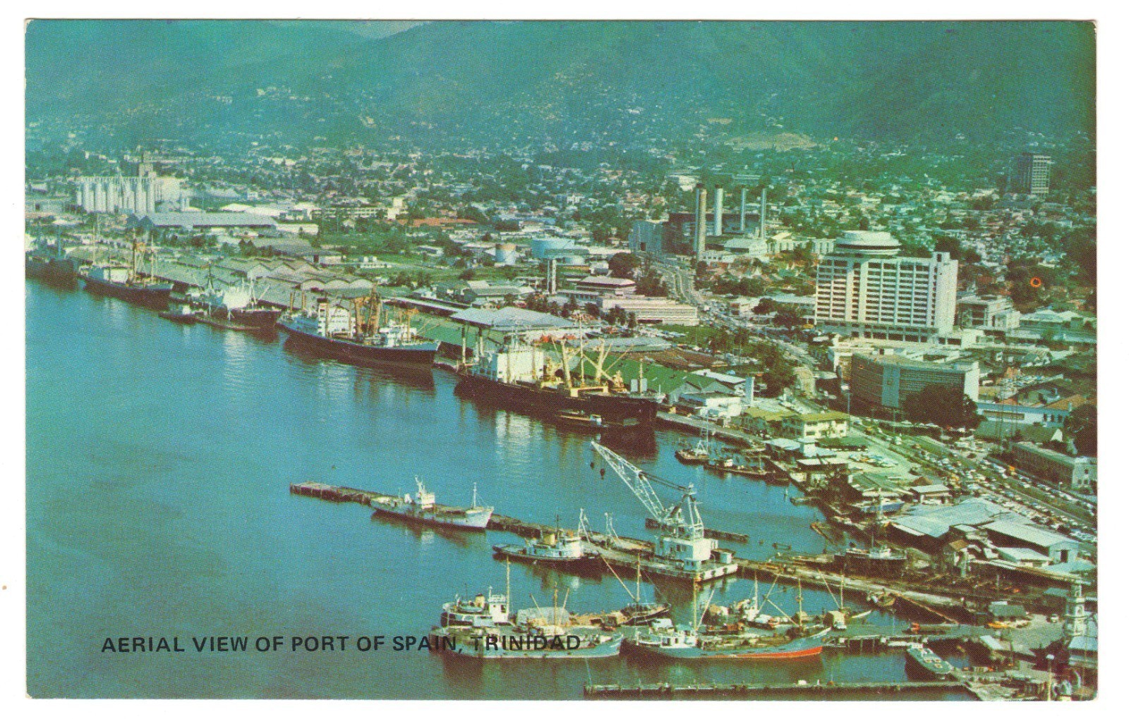
Postcard aerial view of Port of Spain, Trinidad\'s capital city and bustling waterfront positioned on the Gulf of Paria in the West Indies. The image captures the urban landscape with the Northern Range mountains as a backdrop, showing the strategic harbor location that made this city one of the Caribbean\'s most important commercial centers.
- Published by Bon Genie Ltd- Printed by Syncreators Ltd
Port of Spain became Trinidad\'s capital in 1757, transforming from a small muddy seaport into one of the Caribbean\'s busiest commercial centers.
The city was originally founded near the Amerindian fishing village of Cumucurapo, meaning \"place of the silk cotton trees\". British colonial rule formalized in 1802 brought significant development, with the city expanding westward through land reclamation projects that continued into the 20th century.
The waterfront area shown in the card was built on reclaimed land from the Gulf of Paria, which Christopher Columbus originally named the Gulf of the Whale.
This natural harbor became one of the best on the Atlantic coast of the Americas, facilitating Trinidad\'s transformation into a major shipping hub handling exports of agricultural products, oil, and manufactured goods.
During the period when this postcard was produced, Trinidad was experiencing economic growth driven by its oil industry and strategic location.
The Northern Range mountains visible in the background stretch from the Chaguaramas Peninsula to the eastern coast, providing a scenic backdrop to the developing city below.
Shipping and Handling:Carefully packaged to ensure safe arrivalShipped promptly (same day for orders before noon)Tracking information provided
Listing images are scanned at 600 DPI for full detail.
Questions? Feel free to ask!