When you click on links to various merchants on this site and make a purchase, this can result in this site earning a commission. Affiliate programs and affiliations include, but are not limited to, the eBay Partner Network.
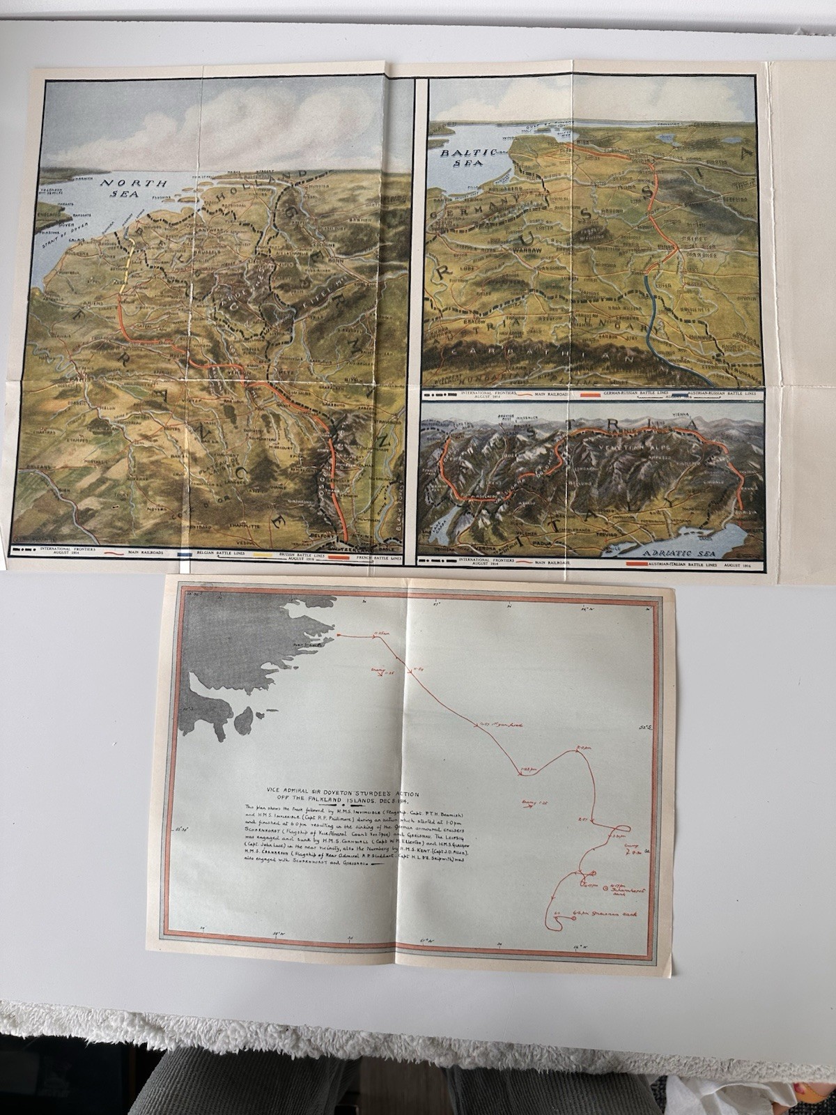
Original World War I Fold-Out Map Lot – 1916 European Battle Fronts + 1914 Falkland Islands Naval Action
Offered is a pair of original WWI-era fold-out battle maps, sold together as one lot.
Included:
1. “Zone Maps” – Europe Battle Fronts – August 1, 1916
• Western Front
• Eastern Front
• Italian-Austrian Front
• Balkan Front
• International Frontiers (August 1914)
• Color-coded battle lines
• Railroad routes marked
• Detailed topographical shading
2. Vice Admiral Sir Doveton Sturdee’s Action Off the Falkland Islands – December 8, 1914
• Naval movement routes plotted in red
• Timed engagement markings
• Notations showing sinking of German cruisers including Scharnhorst and Gneisenau
• Detailed battle progression diagram
Both are original period printings, not reproductions. These were issued as WWI newspaper or magazine supplements.
Condition:
Both maps show typical age-related wear including original fold lines, light toning, and minor edge wear consistent with age. No major tears observed. Please review all photos carefully for exact condition details.
Excellent display pieces for collectors of:
• WWI militaria
• Naval history
• Antique maps
• European military history